
Restrooms
Public restrooms have been reported for a section of Paseo Costero Río Limay near Club Unipol. Availability and hours may change.
Neuquén · Limay River · Argentina
Where the city learns to walk with the river.
An independent guide to Paseo de la Costa: a low-difficulty public riverfront where landscape, movement and pause meet.
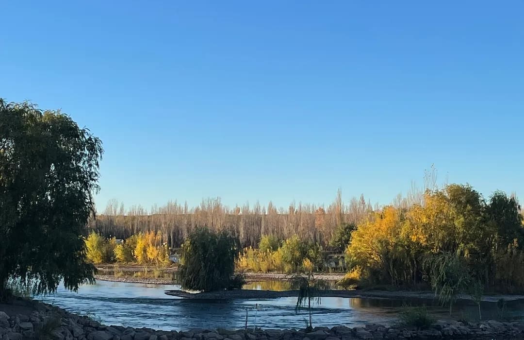
Paseo de la Costa runs along the Limay River and connects different stretches of Neuquén. Municipal public information describes 14 kilometres of riverbank, with marked trails, cycle paths, lighting, viewpoints, fitness stations and rest areas. The route is low difficulty and is intended for shared use by walkers and cyclists.
Paseo de la Costa, also known as Paseo Costero Río Limay, is the main riverfront promenade of Neuquén. It runs along the Limay River in the heart of the city and serves as a starting point for visitors exploring the region.
View municipal sourceWater is both landscape and a changing condition: before approaching the bank, check local signage, weather and the state of the area.
Care note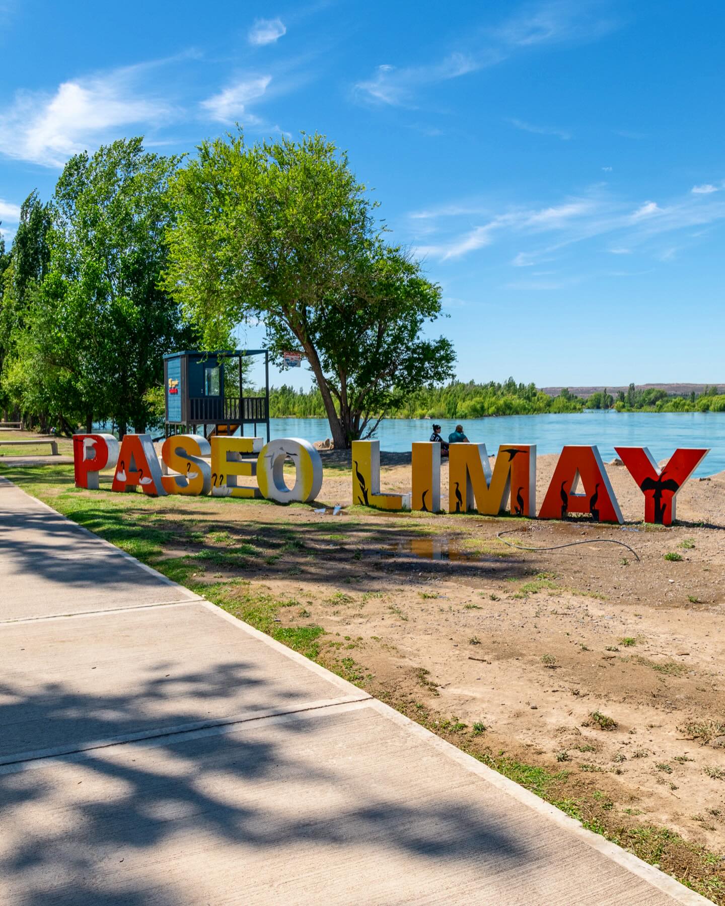
Practical orientation
There is no single version of the walk: choose a section, allow time to pause and check the availability of any specific services you need on the day.
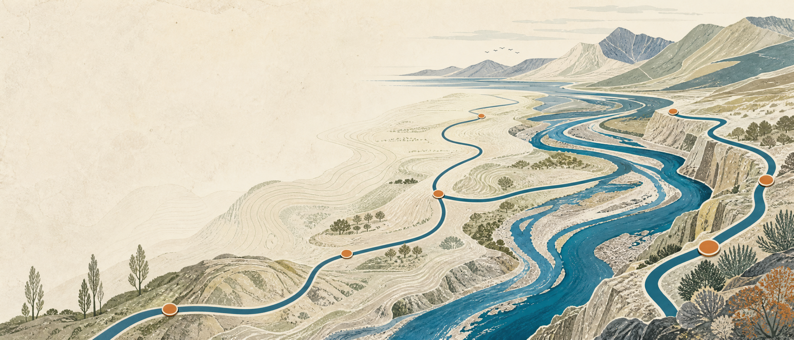
Early hours and late afternoon often provide softer light for walking and looking out across the river. Allow 60 to 120 minutes for a first visit; a cycling route or one with pauses may take longer. In summer, sun exposure and river conditions deserve added attention.
The promenade is presented as an outdoor public space, with no general entry fee indicated. Activities, temporary services or events may have their own conditions—check with their organisers before taking part.
River notebook
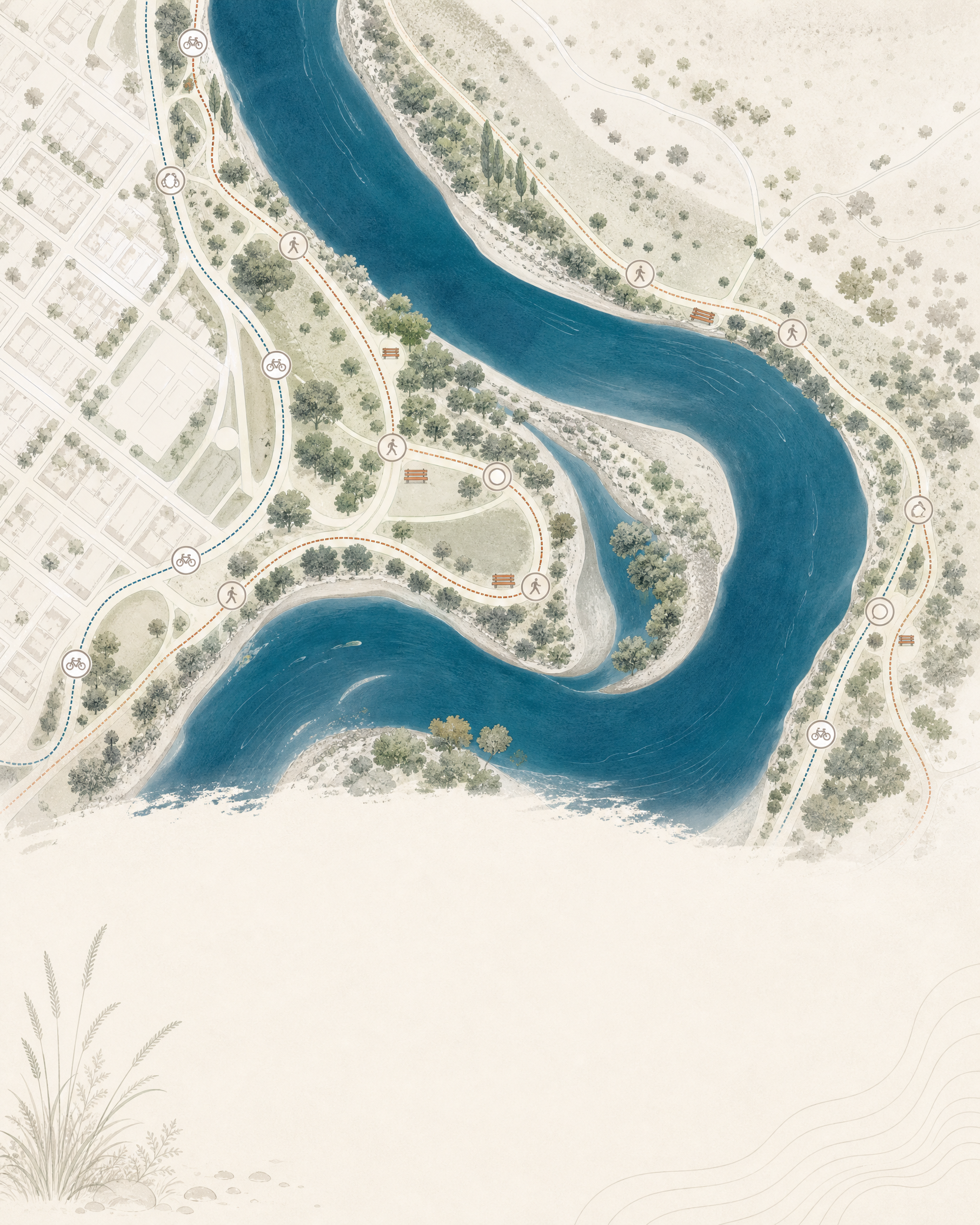
Public restrooms have been reported for a section of Paseo Costero Río Limay near Club Unipol. Availability and hours may change.
Parking areas and stopping zones can be found at different access points. Follow signage and do not block pedestrian paths or cycle lanes.
Urban access points may have food options and places to buy water or supplies. This guide does not endorse individual businesses.
Neuquén's urban area has accommodation, supermarkets, pharmacies and other services. Confirm opening times and access conditions with each provider.
If travelling by vehicle, plan fuel or electric charging before you arrive; these services are not necessarily part of the promenade.
The route includes low-difficulty paths, but gradients, surfaces and facilities differ by section. Plan around your own needs.
Getting there
The map reference sits in the Paseo de la Costa area beside the Limay and Neuquén rivers. Choose your approach according to the section you wish to walk.
Presidente Perón International Airport connects Neuquén with domestic flights. Continue into the city by taxi, remise, rental vehicle or a service available that day; check your drop-off point for the chosen access.
Neuquén Bus Terminal receives long-distance services. From the terminal, check current urban connections or use a taxi/remise to reach the promenade section you want.
Lines and routes change over time. Consult the local trip planner or operator notices on the same day, then alight at a safe, signed access point.
Use the map as a guide, but follow actual road and cycle signage. When the area is busy, drive slowly and share space with walkers.
Starting point
Paseo de la Costa is extensive: the map marks one reference point on the riverbank. Review the surroundings and on-site directions before you start.
Open in Google Maps38° 58′ 45″ S · 68° 03′ 22″ O
Contact phone: +54 299 571-9023
Confluence landmarks
These points help you read the setting of river and city. Actual distance depends on the section where you begin the walk.
A riverbank area within the promenade system, connected with outdoor activities and views across the river setting.
Small observation and rest points appear along the route. Choose one based on light and the time you have.
The landscape where the Limay and Neuquén rivers meet helps explain the geography that structures the city.
Reading the landscape
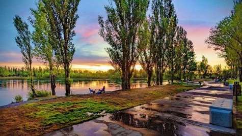
Paseo de la Costa brings visitors close to a place where water, tree cover and city overlap. Rather than a fixed visit, it is a sequence of sections: the Limay River, the nearby Neuquén River and their confluence form a key geographic reference. Walking slowly reveals why the riverbank is at once a recreational space, mobility corridor and shared landscape.
“The riverbank is best understood unhurriedly: by following the light, the wind and the pace of the water.”
Frequently asked questions
Paseo de la Costa is located in the city of Neuquén, in Neuquén Province, Argentina, beside the Limay and Neuquén rivers.
No general entry fee is reported for the promenade as a public open-air space. Individual events and activities may have their own conditions.
For a first visit, one to two hours lets you walk a section and pause. Timing changes with access point and mode of travel.
Yes. Municipal information notes cycle paths and asks cyclists and walkers to share the space. Reduce speed in busy areas.
A public restroom module is reported near Club Unipol for one section of Paseo Costero Río Limay. Confirm availability and hours on the day.
The river calls for care. Do not assume swimming conditions; check signs, weather and official guidance before approaching the water.
There are urban services nearby and parking areas at different access points, but offer and capacity can change. This guide does not recommend specific businesses.
It is a public open-air space available throughout the day. Specific services and activities may keep their own hours; check on site.
Sources and scope
This guide primarily uses public tourism and press information published by the Municipality of Neuquén. For travel decisions, cross-check current opening, access and condition details with official information.
Live weather
13°C
Nublado
Next 7 days
At the promenade and nearby
The promenade is an open-air public space: specific services depend on the section and the season. This guide describes types of services and tips to find them; it does not recommend specific businesses.
Signed public restrooms exist in sections of Paseo Costero Río Limay, for example near Club Unipol and the Confluence area. Availability and hours vary: locate the nearest one to your access before you start.
Parking areas and stops are found at several urban access points. Follow signage, do not block cycle lanes or pedestrian crossings and, in peak season, arrive with margin because capacity is limited.
Kiosks, cafés and food outlets are often near the urban access points. Bring your own water, especially in summer; this guide does not endorse individual businesses.
Neuquén has hotels, apart-hotels, hostels and cabins in the centre and surroundings, a short drive or taxi from the promenade. Confirm availability and rates with each provider.
Supermarkets, pharmacies and various shops cluster in the nearby urban area. If you need supplies or essentials, sort them out before or after the walk.
Service stations and EV charging points are in the city. If arriving by vehicle, arrange fuel or charging beforehand; do not expect them inside the promenade.
The main paths are low difficulty, with ramps and rest points in several sections. Gradients, surfaces and accessible restrooms vary: plan around your needs and check signage.
Detailed access guide
Paseo de la Costa is long and is walked in sections. Choose your access according to the stretch you want to walk and confirm on the day the current conditions.
Presidente Perón International Airport (NQN) is southwest of the centre, about 15 km away. By taxi or remise the trip is usually 20–35 min; you can also rent a vehicle and take RN22 / Acceso Norte into the city.
The Bus Terminal is in the centre. By taxi or remise you reach the promenade in about 10 min; several urban lines run a few blocks away.
The urban bus network connects the centre with different access points. Lines and frequencies change: use the official trip planner on the day and alight at a signed, safe access point.
Services operate at the airport, the terminal and central streets. Prefer licensed ones, ask the estimated fare before boarding and consider ride apps depending on availability.
Approach via Av. Argentina or the waterfront and follow actual road and cycle signage. When busy, drive slowly and share space with walkers and cyclists.
Cycle paths link several stretches of the promenade. Bring a lock and share space with pedestrians; slow down in crowded areas.
Visit strategy through the year
Neuquén lies in northern Patagonia. The table summarises the typical regional climate average; the real daily forecast is in the weather module below.
| Season | Weather and temperatures | River and water | Wildlife | Recommended walk |
|---|---|---|---|---|
| Spring · Sep–Nov | Mild and variable, shifting winds. | Level rises with snowmelt from the mountains. | Active birds; vegetation in bloom. | Soft light, good for a relaxed walk. |
| Summer · Dec–Feb | Warm, strong sun, afternoon storms. | High, fast-flowing river; high exposure. | Coastal bird families; little shade. | Go early or late in the day; hydrate. |
| Autumn · Mar–May | Mild and stable, golden light. | Moderate level, calmer water. | Good for wildlife watching and photos. | Very comfortable for long walks. |
| Winter · Jun–Aug | Cold, frosts, short days. | Cold water; calmer surface. | Less activity; serene mood. | Dress warm and use the midday hours. |
Depending on who comes and how long
Choose by group and pace. All options are low difficulty and share the same riverbank.
Flat stretches near viewpoints and signed restrooms. Half day: stroller on paved sections, pauses on the bank and an outdoor snack.
Confluence and viewpoints at sunrise or sunset, when light is side-on. Bring a tripod and respect authorised areas to avoid damaging the bank.
Paved central accesses with benches and rest points. Short loops, avoiding dirt paths; plan the nearest restroom.
One stretch of your choice + a viewpoint + a pause on the bank. Ideal for a first visit or a break between other city activities.
Several connected stretches + Isla 132 + the river Confluence + a picnic in a permitted area. Bring water, sun protection and an extra layer.
Read the landscape and care for it
Understanding the river helps you enjoy it safely. Paseo de la Costa is a recreational and mobility corridor above a regulated, changing watercourse.
The Limay rises in Lake Nahuel Huapi and its flow is regulated by the Cerros Colorados hydro complex. The water is cold, clear and runs strongly: its state changes without warning.
Poplars, ash trees and grasslands line the route. They shelter birds and give shade; respect them and do not remove plants or disturb the soil.
Gulls, caranchos and chimangos are common on the bank. Watch without chasing and do not feed them: human food puts them at risk.
The river is not a pool: current, temperature and depth vary. Do not assume swimming is safe; follow signage and official guidance.